
After reading dozens of travel blogs and campervan itineraries, we knew we had to plot out our own two week adventure around New Zealand’s South Island. We loved our unforgettable road trips through Idaho and Utah – thanks in part to the wide open landscapes and freedom that came with van camping. As we set our sights on New Zealand we relied on what we had learned in the States to get the most out of our journey looping around the South Island. If you’re thinking of hitting the open Kiwi road yourself, be sure to check out our complementary post on how to prep for a van-based odyssey!
New Zealand’s South Island is a nature-lover’s paradise. About the size of New York State (but with 1/20th the population), the South Island is home to some of New Zealand’s most striking landscapes. From towering fiords and pristine alpine lakes in Southland to the mammoth glaciers of the West Coast and tropical beaches in Abel Tasman, this place has it all! With only two weeks to explore, we plotted an aggressive 1,700 mile (2,700 km) loop around the island. In between long, incredibly scenic drives, we packed in miles of tramping, kayaking, down-hill luging, and just the right amount of aimless wandering that made this South Island road trip our absolute favorite adventure together.
To follow along our day-by-day log of our journey, check out this detailed map of the route we took, key points of interest along the way, the hikes we trekked, and the campsites we called home.
Navigating this itinerary
We cover a lot in this post, so we’ve broken our route down into three sections – you can jump straight to the location and day that you find most interesting.
Days one to five: Tekapo and Pukaki lakes, Southern Alps, Fiordland, Milford Sound, Queenstown
Days six to ten: Roy’s Peak, Haast Pass, Glacier Country, West Coast Driving, Abel Tasman
Days eleven to fourteen: Charlotte Sound, Marlborough Wine Country, Kaikoura, Last Day
Day 1: Christchurch to Mount Cook
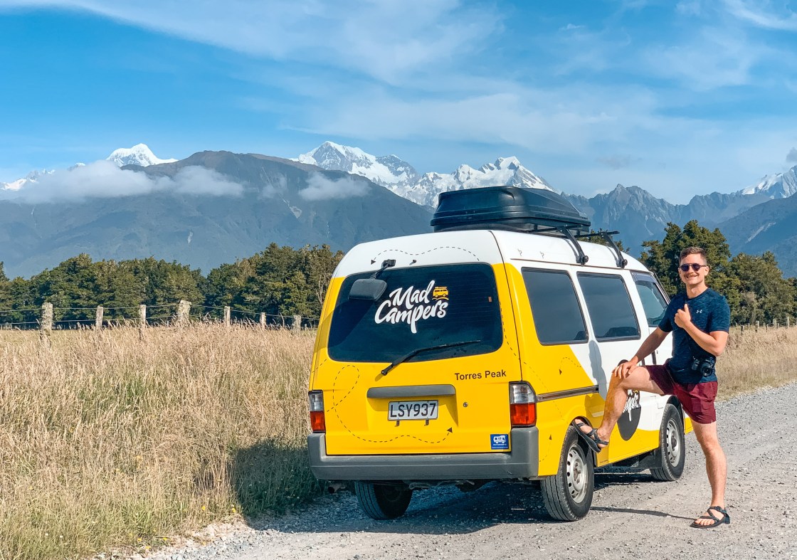
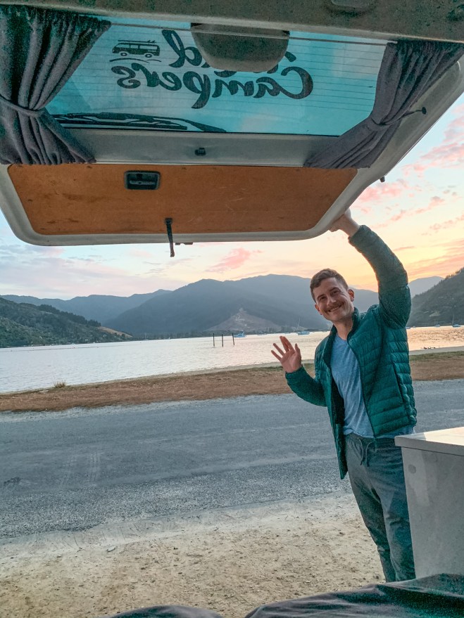
After an early morning departure from Wellington, we met our chauffeur (compliments of Mad Campers) at the Christchurch Airport. A short drive later and we were looking at our very own Mad Camper van, named Torres after the 10,000-foot mountain peak along the South Island’s western ridge. The staff ran us through how to operate and live comfortably in our new home on wheels, and with a reminder to keep left while driving they sent us on our way. Although we were terribly eager to get on the open road, first we stocked up on provisions at a nearby Pak’nSave. Ready for adventure, we struck out south on State Highway 1 toward Lake Tekapo.
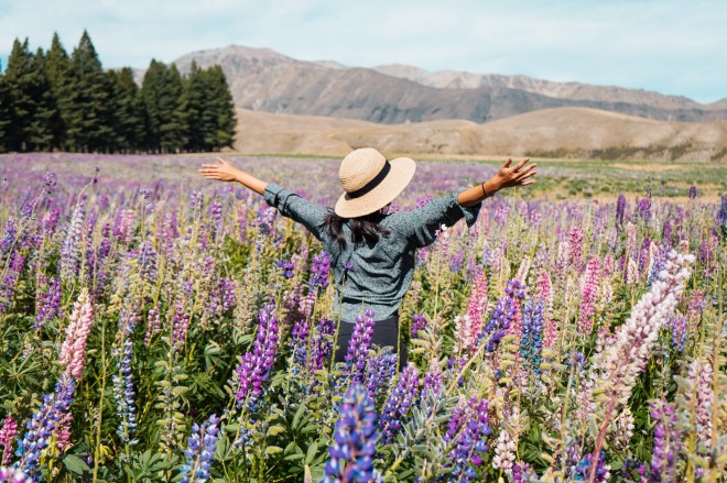
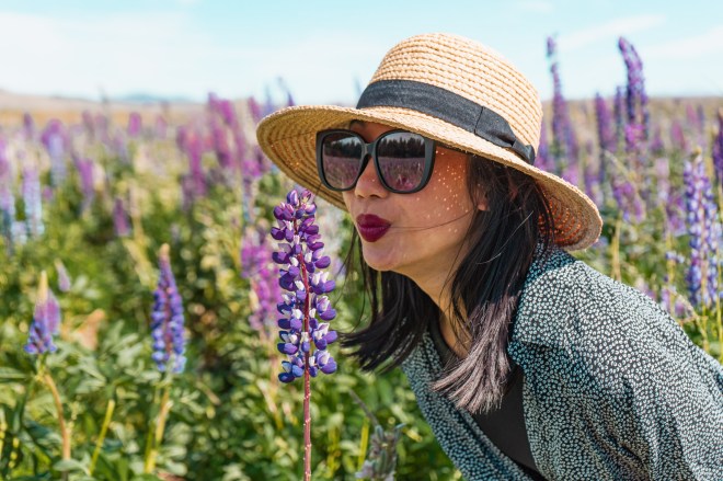
As Christchurch disappeared behind us, modest homes and businesses gave way to wide open meadows and blustering crosswinds. At last our journey through New Zealand’s natural splendor had begun! Just before arriving at Lake Tekapo, Victoria caught a glimpse of the famed wild lupins that bloom from mid-November until the end of January. We pulled over and dashed into the field, fro-locking around like Julie Andrews from the Sound of Music. It’s a tad ironic that the now iconic lupin fields in New Zealand are invasive garden plants imported from the UK, but this doesn’t detract from their charm against the turquoise-blue glacial waters of Lake Tekapo.

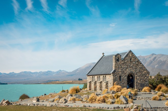
After a quick stop at the wildly photogenic Church of the Good Shepherd on Lake Tekapo’s shore, we hopped on State Highway 8 toward Aoraki / Mount Cook. Soaring into the sky at over 12,000 feet tall (3,700 meters), this mountain peak bears both its traditional Maori name meaning “cloud piercer” as well as its English name honoring Captain James Cook. The famed English explorer and his crew made the first detailed maps of New Zealand, used the islands as their base of operations, and observed and categorized the region’s flora and fauna. We first sighted Aoraki / Mount Cook soon after leaving Lake Tekapo, and it stayed in view as we drove up to Lake Pukaki.
With stunning glacial waters to our right, we drove the length of Lake Pukaki and landed one of only two available sites at the White Horse Campsite. Renowned for its prime location in the middle of the Southern Alps, this D.O.C. campsite fills up fast with experienced mountaineers and amateur trekkers alike. We cooked up a warm meal of pasta and sausage, took in the starry night sky, and slept soundly as wind whipped against our little home on wheels.
Day 2: Southern Alps Exposure
We woke fresh and rested to a beautiful cloudless morning. The severe winds from the night before had thankfully passed. A little yogurt, granola, and French pressed coffee became our morning breakfast ritual. With food and caffeine in our bellies, we packed for our first South Island tramp along the famous Hooker Valley Track.

This well-formed, easy, three mile track is New Zealand’s most popular, and we could easily see why. The track led us between mountain peaks and over wooden suspension bridges to its terminus at Hooker Lake. From here we basked in an unobstructed view of the towering Aoraki / Mount Cook. If our first day felt like an orchestra’s prelude to a Broadway show, this was the dramatic opening act. Named the Southern Alps by James Cook for its jagged peaks reminiscent of the Alps in Europe, this 300 mile (500 km) long mountain range formed over the last 45 million years as the Pacific and Indo-Australian tectonic plates butted against each other. Since this is one of the world’s most active fault lines, the earth will continue to raise up into the sky for millions of years to come. With these eons of geologic history behind us, we hopped back into our van to make the multi-day drive south to New Zealand’s famous Fiordland and pristine Milford Sound.

Although we had a lot of driving ahead of us, we made a quick stop at the NZ Alpine Lavender field for some seriously picturesque views. To top things off, we accidentally came across some of the best sashimi we’ve ever enjoyed. Sold by Mount Cook Alpine Salmon out of the Lake Pukaki Visitor Centre, we got two platters of sashimi for the price of one, solidifying our love of Lake Pukaki.

We zoomed through wide open plains, and climbed up the verdant, rolling mountains of the Lindis Pass. As we topped out and began descending into the Lindis Valley, we noticed how quickly our little camper guzzled gas and how few gas stations existed between destinations. After barely making it to Cromwell where we fueled up, we scouted a free camping site at Lowburn Harbour on Lake Dunstan. We backed into an empty space and watched the sun set over the gently rolling lake water.
Day 3: Drive to Fiordland
In the morning we were greeted by a team of ducks pacing back and forth through the campsite. Fearless of their human neighbors, the ducks tried to make friends with us (and our breakfast). After saying goodbye to the friendly ducks, we hopped onto State Highway 6 toward Queenstown. We made a quick pit stop in Arrowtown, to visit a small pioneer gold rush town frozen in time. The allure of quick riches compelled European and Chinese settlers to put down roots throughout the Otago region, similar to the California gold rush of 1849. Arrowtown is the best preserved example of the rush towns in the region, and we were delighted by its pioneer charm and surrounding natural appeal. Make sure to check out the Chinese Settlement while visiting Arrowtown to get a full picture of how pioneers from all over the world lived in this untamed country.
Eager to make good time to Fiordland, we zoomed past Queenstown and into the rich agricultural valley below. It’s worth mentioning that the rumors are (mostly) true: sheep reign supreme in New Zealand. Over 30 million graze between the North and South Islands – that’s six sheep for every Kiwi (down from 22 sheep per person in the early 1980s)! We drove by seemingly endless sheep ranches during our road trip.


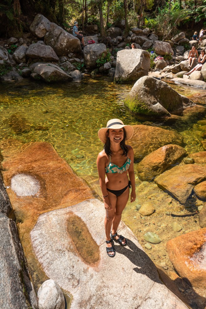
Before long we arrived at Te Anu, the Gateway to Fiordland, and stopped at the Fiordland National Park Visitor Center. The name “Fiordland” is derived from the variant of the Scandinavian word for the steep “U” shaped valleys, or “fjords”, that dominate this region. The stunning natural features were carved out by an ice-age glacial system over millions of years. Most of the valleys are so steep and difficult to navigate that the entire region remains mostly untouched by industry, earning it the UNESCO World Heritage Site distinction. With plenty of sunlight left in the day, we chose a moderately difficult alpine hike about an hour outside of Milford Sound. The Lake Marian Track starts with a spectacular series of waterfalls, followed by a steep, rocky ascent to Lake Marian. Our favorite hike of the trip, the challenging ascent is worth the effort once you step out of the forest and dip your toes into this spectacularly pristine alpine lake.

Feeling accomplished after our trek, we drove Torres (by now we were in the habit of calling our van by her name) to Cascade Creek – a stunning, well maintained D.O.C. campsite. Even though it’s the closest available campground outside Milford Sound, we had no problem finding a picturesque site. We shared risotto and wine as the sun set over the ridges of fiords.
Day 4: Milford Sound
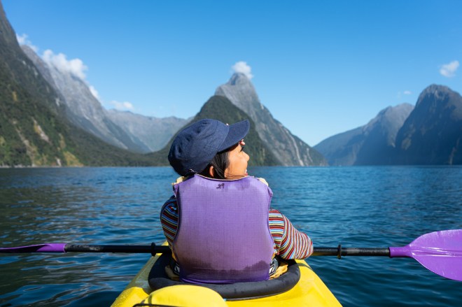
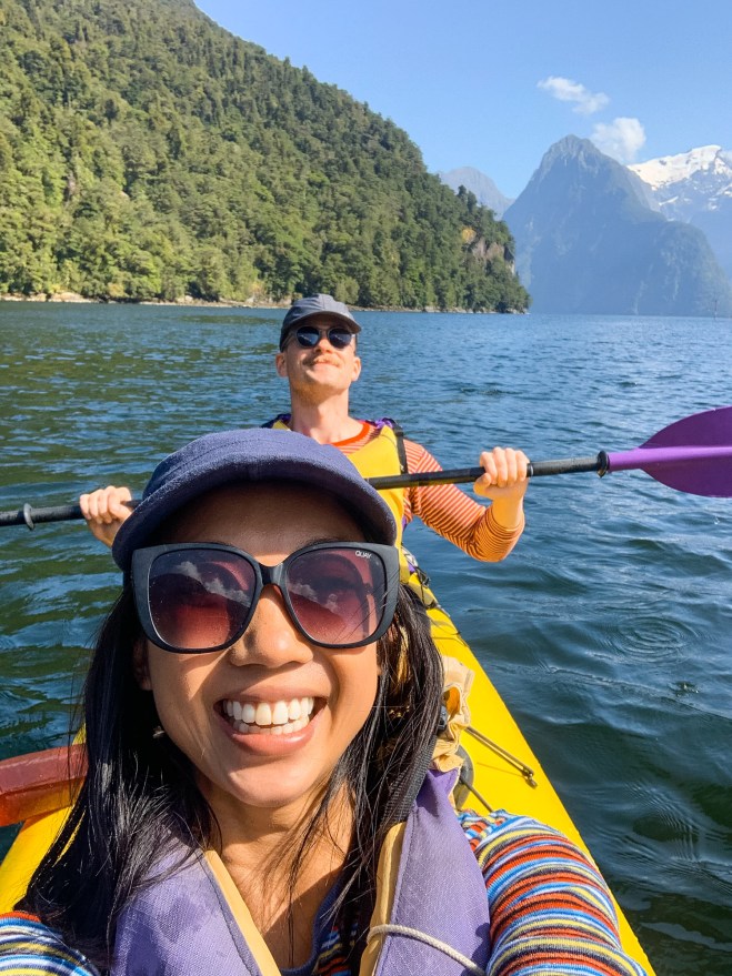
Certainly the most famous fiord in New Zealand, Milford Sound is the top destination for adventures visiting Fiordland (yes, it should be “Milford Fiord”, but the initial incorrect classification stuck). We got moving just before sunrise in order to make our early morning kayaking tour on Milford Sound’s famously placid waters. Rosco’s Milford Kayaks is the O.G. kayak guide on the fiord. Although most of the dozen or so kayakers were slated to paddle the full ten miles (15 km) of the fiord, we and one other couple opted for the shorter (and cheaper) jaunt crisscrossing Freshwater Basin. We paddled out in almost perfectly still waters under clear blue skies – the water mirrored every detail of the surrounding mountains with the famed Mitre Peak in the center of our view. Apparently we lucked out with the weather, since Milford Sound is one of the wettest places on earth, receiving over 250 inches (630 cm) of rain a year. Our journey through Milford Sound brought us to the fiord’s mouth and base of the fiercely impressive Bowen Falls.
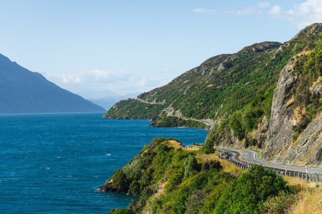
Since we didn’t see much while driving in, we were stunned by the incredible views, sheer drops, and towering ridges on our drive out of Milford Sound. The road is sometimes narrow, steep, and winding, but we made sure to snap pictures and bask in the monumental landscapes that surrounded us. We were sad to be leaving such a spectacular region, and we recommend taking more time here than we did if you can. While passing through Te Anu, we stopped at McKeown CardFuel to fill up. A flock of friendly, freshly shaven alpacas bobbed their way over to us. We delighted in their company before saying a final “goodbye” to Fiordland and retracing our route back to Queenstown.


In need of a hot shower and some creature comforts, we rented a small RV site at the Queenstown Top 10 Holiday Park. Feeling clean and refreshed, we considered going out for a night on the town, but exhaustion hit us like a ton of bricks and we opted for sleep instead.
Day 5: Day in Queenstown
Feeling well rested, we devoured breakfast, checked out of the holiday park, and zoomed down the hill to Queenstown. With over 200 adventure sports and activities available to visitors, the resort town is a veritable mecca for thrill seekers and vacationers alike. You can find everything from jet skiing and bungee jumping to paragliding and downhill luging during the summer season.
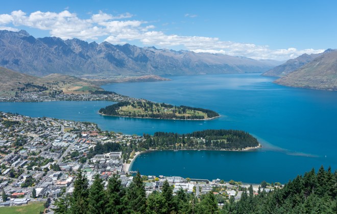
We parked Torres in a public lot, walked past the Village Green, and made our way to Queenstown’s charming lakefront. We were greeted with a cavalcade of street performers, artists, and vendors, all framed by the majestic lake Wakatipu in the foreground and Cecil Peak in the background. Before checking out some of the more adventurous activities in town, we strolled through the Queenstown Gardens – an immaculately kept park with both natural and elegant man-made features.
After enjoying lunch on the beach and a couple beers in town, we rode the Skyline Queenstown gondola up to the Ben Lomond Scenic Reserve. Once there we took in some spectacular views of the town and landscapes below. The real treat, however, was the downhill luging track at Skyline Luge, which we raced down different tracks a few times to see which one of us was more fearless (or heavier). These luges sent us flying down the slope much faster than we expected!


We explored more of this quaint little resort town after coming back down to earth. Regretfully we missed out on some of the more exciting activities, like jet boating, canyon diving, and bungee jumping, due to their high cost. We were trying to keep to a budget after all… Realistically, the luging checked off our adventure box for the day, so we decided to get back on the road. Looking back, we wish we had a few days to really immerse ourselves in Queenstown’s nightlife and daytime shenanigans – this is a seriously fun town after all. We made plans to return, and zoomed off to claim a spot at what became our favorite campsite of the trip.
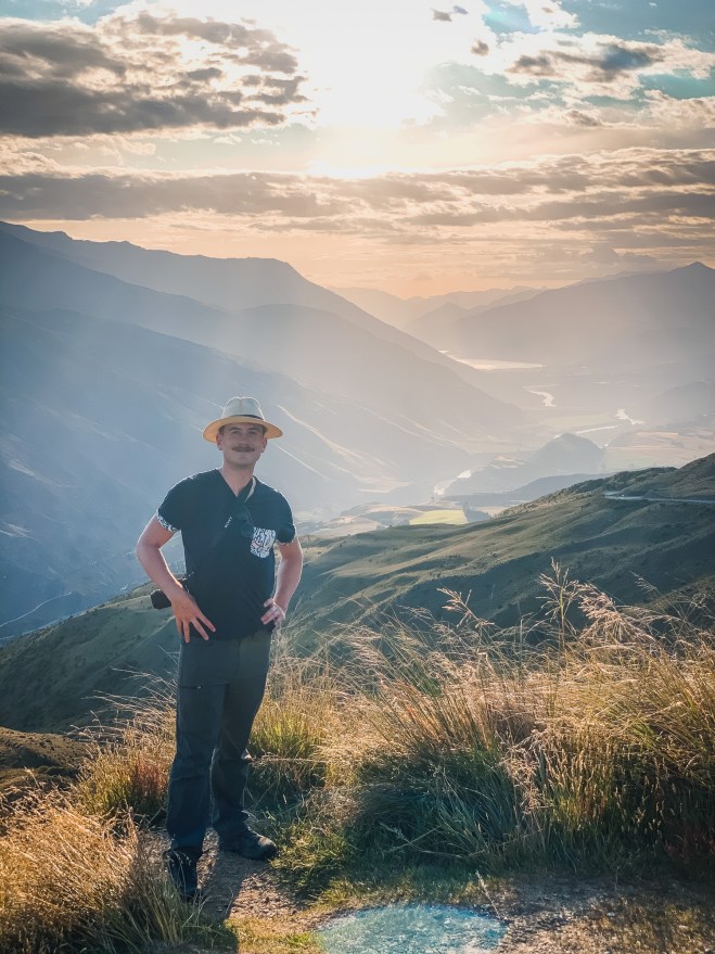
Situated next to New Zealand’s highest elevation road, Crown Range Summit offers amazing views of the valley below from a small car park that allows overnight free camping. We raced up the zig-zagging road, hopeful we could snatch a spot right on the edge of the peak. The somewhat harrowing drive was worth it as we squeezed between two campers for the last available site. Tussock and grass surrounded us, as we were well above the tree line below. We prepped dinner and witnessed the type of sunset that makes you totally rethink your place in the cosmos. Speaking of the universe above, thousands of twinkling stars and the faint band of the Milky Way greeted us as night took over day – incredible.

Day 6: Roy’s Peak
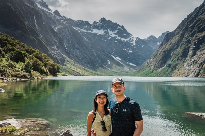
We woke up on the edge of the world equal parts excited and nervous. Several days earlier we committed to hiking Roy’s Peak, a popular ten mile out and back track with a grueling 4000-foot (1,200-meter) ascent over an average 16% grade. After a hasty breakfast, we drove along the scenic Cardrona Range Road, briefly stopping at the quaint and still sleeping Cardrona Hotel before arriving at the base of Roy’s Peak. If you’re contemplating hiking the track yourself, or are curious to learn more about our experience, be sure to check out our Hiking Roy’s Peak post!

In short, the track is definitely a worthwhile challenge. We kept our momentum going for the five mile hike up to the peak, and the 360-degree views from the top are absolutely astounding! We could clearly see Mount Aspiring from over 25 miles away, and Lake Wanaka looked like a pond from our vantage point. After savoring lunch while perched on top of the world, we made our way back down the track, taking numerous breaks to hang out with the friendly grazing sheep. Tired and sore from the hike, we cracked open a couple beers and rested on the beach by Lake Wanaka. Somewhat refreshed, we started driving north on State Road 6 to snag a lake camping spot at the D.O.C. Boundary Creek Campsite.


Day 7: Haast Pass
The Southern Alps create an almost impenetrable wall between the South Island’s West Coast and its other regional governments. Only three mountain passes connect this fortress region with the rest of the South Island: Lewis Pass in the north, Haast Pass in the south, and Arthur’s Pass midway between the two. Driving north along State Highway 6 with Lake Wanaka in the rear-view, we were suddenly surrounded by the precipitous ridges of Mount Aspiring National Park. We had entered the “gates” of Haast Pass. Named after the 19th-century provincial geologist Julius von Haast, this 50 mile (80 km) route provides a full day of adventure with numerous short tracks and viewpoints along the way. We put Torres into low gear and started up the 1,800-foot (550-meter) ascent.
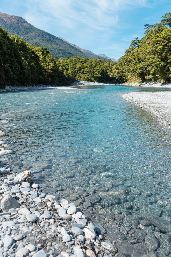
Since we planned to reach the West Coast’s famous Fox and Franz Josef glaciers by the following day, we decided on three stops while driving through Haast Pass. We made our first stop at the Blue Pools track just before Cameron Flats – this short track leads you to a series of crystal clear deep river pools where the Blue River joins the Makarora River. They give off a uniquely blue appearance from sunlight refracting on the clear and icy glacial river water. We looked on as more daring visitors jumped from a swinging bridge into these frigid waters below. Admiring the striking blue waters from above was enough for us at the moment.

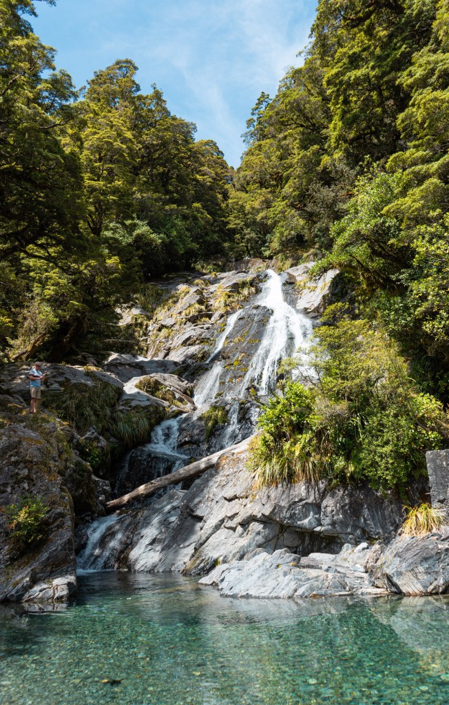
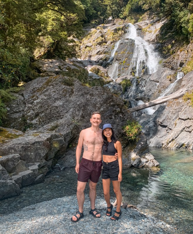
By the time we stopped at Fantail Falls, however, peak heat had hit and we were ready for a dip. This stunning 75-foot (23-meter) waterfall spills into the Haast River itself. Eager to cool off, we plunged into the icy pool that forms at the base of the waterfall. The incredibly clear and frigid water was the perfect antidote to any mid-day largess we may have felt. Feeling fresh and alert, we continued north along the pass, breaking once more at Thunder Creek Falls. This towering 315-foot (96-meter) waterfall is named after the thundering noise it casts across the valley. Unfortunately we couldn’t stay long, since sandflies swarmed us the moment we stepped near the waterfall’s base. We had heard about these little buggers from fellow travelers, and experienced their terribly itchy bite the night before while camping by Lake Wanaka. With the day beginning to fade, we hoped to leave the sandflies behind and drove non-stop through the rest of Haast Pass.
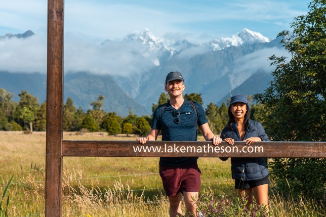
Suddenly the ridges surrounding us gave way to the Haast River plain, and we sighted the Pacific Ocean in the distance. We had officially made our way to the South Island’s West Coast region – a geographically isolated, untamed wilderness running from Fiordland in the south to Tasman in the north. The region is well known for its ancient forests and active glaciers. We cautiously winded our way up and down several mountain passes before arriving at the base of Fox Glacier. We took a short detour along Cook Flat Road near Weheka village to catch a breathtaking view of the Fox Glacier from afar. With some time to spare, we walked around nearby Lake Matheson to see the famed mirror-like reflection of the Southern Alps against the still lake water. With a full day of adventure behind us, we drove a little past Franz Josef Glacier to find a site at the D.O.C. Otto/McDonald’s Campsite. There we caught another brilliantly radiant sunset over lake Mapourika.

Day 8: Glacier Country
Glaciers are fierce, dynamic rivers of flowing ice. Fed by year-round snowfall atop the peaks of the Southern Alps, the Fox and Franz Josef glaciers continue to sculpt deep valleys as they slowly flow into the Pacific Ocean. We arrived early at Franz Josef Glacier’s outwash plain – the morning fog had yet to burn off. Eager to see this icy behemoth up close, we struck out on the Franz Josef Glacier Track that leads right up to the glacier’s base. The track starts atop moraines, which are fields of rocks and boulders deposited by the glacier. Although New Zealand’s glaciers will occasionally advance during particularly wet winter seasons, they have been generally retreating at a steady rate since the late 19th century. Most of the track we hiked had once been covered by hundreds of feet of slowly flowing ice above. The morning fog had yet to burn off by the time we got to the base of the glacier, but we hadn’t noticed at first. Suddenly the fog parted, opening its curtains to the icy wall that rose to the mountain peaks in the distance. The grand reveal made for a spectacular experience, but we’ll definitely return and book a guided tour to get closer to these gargantuan icy formations.

As we made our way back along the barren moraines, we took notice of the varied flora in this region. We left alpine forests behind us at the base of the glacier and walked through thickening brush and ferns, ending our trek under large clusters of palms. In one short walk we experienced the quickly shifting, diverse flora and landscapes that defined our entire South Island road trip. Case in point: we left Glacier Country heading to Abel Tasman – a lush, tropical national park, replete with palms, white sand beaches, and endless summer days.
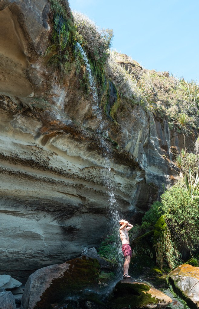
We had a long drive ahead of us, so we decided to stay the night outside of Hokitika, a small coastal town known for its jade jewelers. Before staking out a campsite, we took a considerable detour to the Hokitika Gorge. Similar to the Blue Pools in Haast Pass, this gorge on the bank of the Hokitika River sports pristine blue-green glacial water. We slowly waded our way into the crystal clear, frigid river, making sure not to lose our footing and get swept away by the fierce current. As the sun faded in the sky, we drove back toward Hokitika and arrived at the D.O.C. Lake Mahinapua Campsite before sunset. The lake itself formed underneath an ancient glacier thousands of years ago, uncovered by retreating ice at the end of the last ice age. We may have left Glacier Country behind, but the remnants of New Zealand’s glacial past can be found everywhere.

Day 9: West Coast Driving
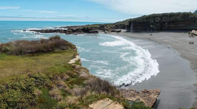
Sandflies and mosquitoes are definitely a nuisance along New Zealand’s entire western coast. After a few careless nights and mornings when the buggers are most active, we had amassed terribly itchy bites all over our ankles and arms. We left our lakeside campsite just after we woke, hoping to avoid any more bites, and parked by Hokitika beach to enjoy our usual breakfast and coffee. With a full day of driving ahead of us, we started north along State Highway 6. Before long we crossed into Paparoa National Park, famous for its Pancake Rocks near Punakaiki village. This section of the coast is composed of thousands of interlacing layers of limestone and granite. Since the limestone is formed from ancient deposits of sea life, it is particularly water soluble and erodes faster than the layers of granite, giving these rocks their distinctive “stack of pancakes” look. We meandered through the coastal track, viewed a pod of dolphins in the distance, and almost bought an actual stack of edible pancakes before continuing north.

We made it maybe two miles before stopping again at the head of the Truman Track. This little trail darts through thick brush, ferns, and palms before terminating at a serene, secretive ocean bay. Although we were already running behind, the stop was more than worth it. We felt like we were on the edge of reality, seeing an endless Pacific Ocean in one direction and bizarre limestone formations in the other. Satisfied by our West Coast adventure, we hopped back in Torres and made haste toward Abel Tasman.

Situated at the north end of the South Island, Abel Tasman National Park is named after the Dutch explorer who first sighted New Zealand in 1642. The region is known for its subtropical flora, yearlong mild weather, and gorgeous white sand beaches. We planned to reach it by sundown, but we were still on the wrong side of the Southern Alps. After another 45 minutes driving north, we stayed on State Highway 6 as it veered east through the Buller Gorge. This winding route followed the Buller River that carves its way through the mountain pass. Much of the region had been extensively logged since the 1800s, and the old, natural growth we had enjoyed driving through the West Coast gave way to monoculture tree plantations.
These lands along with numerous forests in both the North and South islands were managed by the New Zealand Forestry Service until 1987. That year the government disbanded the forestry service, sold off various holdings to the logging industry, and created the Department of Conservation to steward New Zealand’s natural beauty for kiwis and visitors alike. The D.O.C.’s current vision is for “New Zealand to be the greatest living space on Earth”, and we can affirm that they’re doing something right!
With the sun setting behind us, we arrived at Motueka for a needed shopping run. After stocking up on our essentials, we took the winding Riwaka-Sandy Bay road near to the entrance of Abel Tasman National Park. We booked two nights at The Barn Backpackers holiday park. Located adjacent to the Abel Tasman Coastal Track trailhead, The Barn is the perfect mix of backpacker community, amenities, and access to nature. We showered, ate, and enjoyed the setting sun, excited for a full day in the park tomorrow.
Day 10: Abel Tasman
Even though Abel Tasman is New Zealand’s smallest national park, it is overbrimming with things to explore. We chose to take a water taxi to Anchorage Bay and slowly make our way back along the Abel Tasman Coastal Track. There are several companies that ferry folks from Marahau or nearby Kaiterteri to a series of stops along the Abel Tasman coast. We were able to book a morning ride with Aqua Taxi direct from The Barn Backpackers – easy! A bus picked us up in front of our holiday park and delivered us to the Aqua Taxi office. There we boarded our boat which was towed by tractor to a nearby beach. The tractor drove straight into the water, launching us into the Pacific – we were on our way!


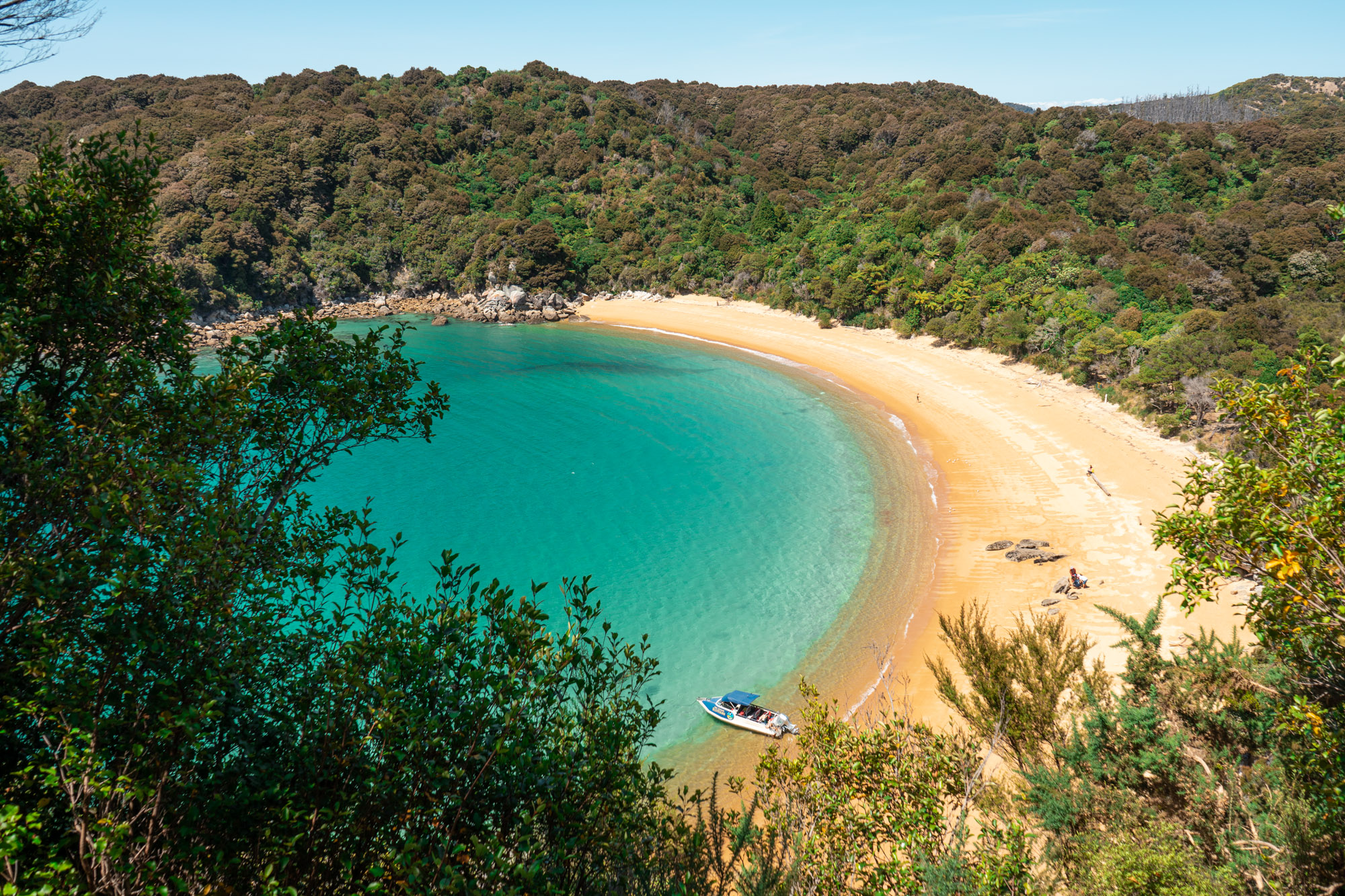
Our quirky guide and captain first took us by the photogenic Split Apple Rock before rocketing along the coast to Anchorage Bay. This wide, protected bay is perfect for mooring yachts or delivering loads of eager trekkers. We hopped off our taxi and started straight for the Pitt-Head Track. This short loop track took us first to a viewpoint overlooking Anchorage Bay and then alongside Te Pukatea Bay. Aching for a late morning dip in the sensationally clear ocean water, we tramped down to the beach. Totally alone, we felt like we had stumbled upon pure tropical paradise. Although we didn’t have time to explore the many pristine bays and beaches along the Abel Tasman coast, that was quite fine since Te Pukatea Bay blew all our expectations away.
After enjoying a long lunch at Te Pukatea Bay, we returned to the Pitt-Head Track and started hiking toward Cleopatra Pool. About an hour’s walk from Anchorage Bay, this radiant green pool gets its color from the moss growing on its rocks. We dipped ourselves in the temperate pool and slid down a mossy rock waterslide. Since we bought a one way trip in by boat, we needed to get hiking along the last quarter of the 37 mile (60 km) Abel Tasman Coastal Track to get home before dark. This shaded track winds its way from Totaranui Bay at the north end of the park to Marahau village in the south.

We started tiring after hiking more than a dozen miles in water shoes, and our feet began blistering by the final few miles leading back to The Barn. Sore and exhausted, we rejoiced after sighting our campervan. We noticed numerous campsites and campers in Abel Tasman proper, and we’ll definitely book a site during our next visit to get the most out of this tropical national park. Comfortably situated back at The Barn, we showered, did a load of laundry, and collapsed on our bed in exhaustion.
Day 11: Drive to Charlotte Sound
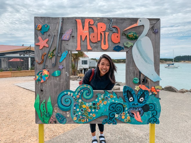
Up until this point we had been lucky when it came to weather – every day greeted us with endless sun and clear skies. We woke to our first overcast day since landing in Christchurch, and decided to drive straight to the Marlborough Sounds rather than book a morning kayak trip along the Abel Tasman coast. Driving south along State Highway 60, we made a quick stop at the Mapua Wharf for lunch. This quaint little collection of shops and restaurants perfectly captures the spirit of the fishing industry that dominates the north coast of the South Island. We put in a fish and chips order at the Smokehouse Cafe, and we were pleasantly surprised by the massive platter of freshly fried fish that we received.

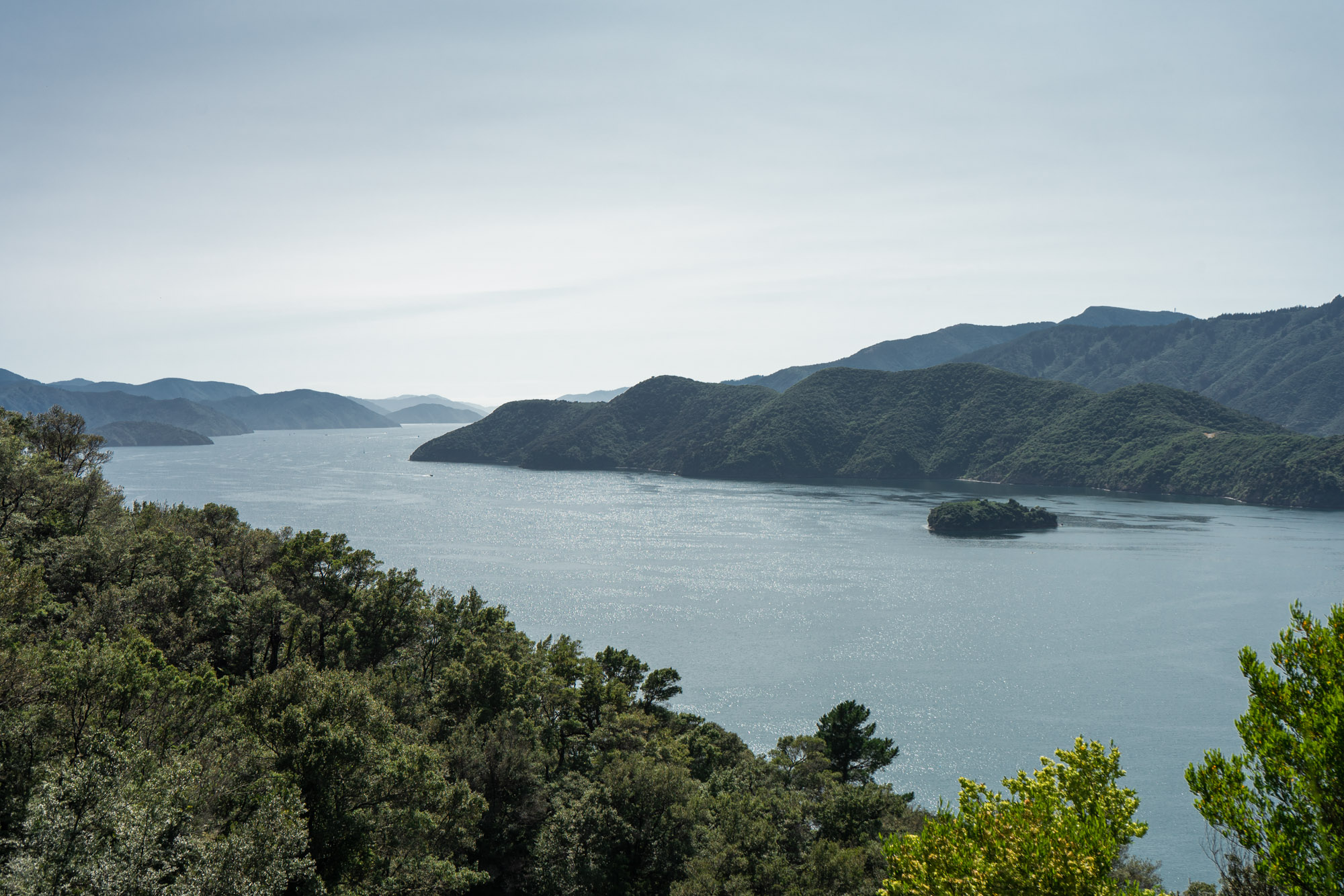
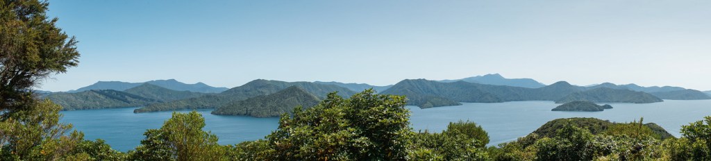
Continuing east, we made a second stop in Nelson. This small city is full of charm and a rich diversity of tree species. We strolled through the town center, sampling some delicious cappuccinos at Kush Coffee before taking State Highway 6 toward Marlborough Sounds. Covering more than 1,500 square miles (4,000 sq km), this fractal-like region accounts for one tenth of New Zealand’s total coastline. Whereas the fiords in Southland were formed by glaciers etching out deep valleys, the sounds in Marlborough formed when seawater flooded mountain valleys as the Southern Alps sank into the Cook Strait. We zig-zagged through mountain pass after mountain pass, breaking for dinner at the famed Muscle Pot in Havelock. After stuffing our faces with the distinct green muscles farmed in the region, we hurried through the next valley in search of a spot along the sound to camp at. Again, we lucked out and snagged the last of five free campsites across from Outbound New Zealand along the Grove Arm of Charlotte Sound.

Day 12: Marlborough Wine Country
We woke just before dawn to catch the sun rise over the sound. New Zealand’s South Island is full of incredible camp grounds of all types, and we were thrilled to experience such a tranquil, serene sunrise at this gorgeous little slice of the Marlborough. After snagging a couple more hours of sleep, we drove to Picton and started hiking the Snout Track just outside this port town. The track is heavily wooded, but it offers a few breathtaking views as you trek up and down the Victoria Domain before reaching the Snout. From here we marveled at the massive Interilander ferries navigating between sunken mountain ranges along the Charlotte Sound. This critical transit route connects the North and South Islands by way of Picton and Wellington, delivering people, cars, and goods between the two islands. With the midday heat bearing down on us, we hiked back to Torres and started driving south to Marlborough’s world renowned wine country.
We descended into the Marlborough valley and took State Highway 62 west, passing endless vineyards and wineries. Since we are law abiding drivers, we made only one stop at the Waiaru River Winery. We prefer more casual, unpretentious wineries, and this one checked both boxes. Marlborough is best known for its pungent, zesty white wines made from the Sauvignon Blanc grape variety, and we got to sample several along with a Pinot Noir. Although Sauvignon Blanc accounts for two thirds of all wine produced in the valley, Pinot Noir vines recently came of age and are increasingly served and sold at wineries throughout the region. Commercial viticulture started here in the 1970s, and the region’s wine quickly took the world by storm in the following decades. Marlborough’s mild maritime climate and rich soils make it ideal for wine growers and wine lovers alike. We bought a couple bottles and made our way back to the Pacific Coast.
Before scouting out a camp site, we took the advice of our wine server and drove the harrowing drive to Whites Bay beach along the coast. This may have been the trickiest of drives on a road trip full of wild, curvy driving, but the beautiful, protected waters were worth the journey. After sunning and bathing in the waning sunlight, we deftly maneuvered our way back to Cloudy Bay and easily found a space at the D.O.C, Rarangi Campsite right on the shore.
Day 13: Cloudy Bay to Kaikoura
It’s no wonder where they got the name for Cloudy Bay – we couldn’t see more than a few hundred yards in any direction in the morning’s thick ocean fog. We started driving south toward Kaikoura, our last stop before returning to Christchurch. The wide, wine growing plains disappeared behind us as we left Marlborough, but we weren’t done tasting what the region had to offer just yet. We found a highly rated vineyard just east of the town of Seddon, and decided to make a quick detour. All of a sudden we were surrounded by endless rolling hills covered in thousands of rows of grapevines. Were we in heaven? No, this was the Yealands Estate.
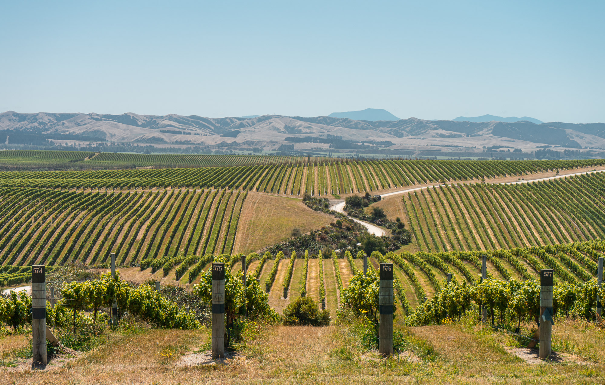
Founded in 2008, the vineyards cover over 2,500 acres of the Awatere Valley foothills. Once considered unsuitable for viticulture, these bucolic rolling hills are now covered in Sauvignon Blanc, Pinot Gris, and Pinot Noir grapevines. Through a cheeky video at the visitor center we learned how the winery was founded on sustainable practices, and is aiming to reduce its carbon footprint 80% by 2045. We then enjoyed a quick tasting and started a self-guided driven tour of the vineyards. Making stops to see their famous baby doll sheep, a monumental view of Cook Strait from atop a cliff, and a delightful butterfly garden, we felt like we were in the Disneyland version of a vineyard. Thoroughly immersed in wine culture, we hopped back on the main road headed to Kaikoura.

The coastal drive along State Highway 1 brought us right up against the roaring Pacific Ocean. Kaikoura sustained heavy damage during an earthquake in 2016, and work crews are still rebuilding roads and freight lines along this narrow path between the mountains and sea. The region is well known for hosting a myriad of friendly sea creatures, and so we pulled over at the recently completed Ohau Look Out to try and sight some seals. We poked our heads over the railing and delighted in the sight of dozens of New Zealand fur seals sunbathing and playing on the rocky shores below.


Found on the southern shores of Australia and all over the shores of the South Island, these friendly creatures concentrate themselves along the rich waters near Kaikoura. Eager to get closer to the seals, we decided to book a guided kayaking tour for the next morning and hopped back on the road. Thirty minutes later we were parked in a private lot for campervans next on the Kaikoura Peninsula. We ordered a couple of draft beers from the nearby Pier Hotel and watched the sun set on our last night with Torres.
Day 14: End of an Adventure
We didn’t have much time to savor our final morning on the road, since we had booked an early guided tour leaving from the office of Seal Kayak Kaikoura. After meeting our very chill guide and fellow kayakers, we drove to the tip of the Kaikoura Peninsula with kayaks in tow. The peninsula causes upswelling currents that bring marine life up from the depths of the Hikurangi Trench. Seals and whales love the resulting abundance of food, making Kaikoura one of the best places to catch these creatures in their natural environment. We pushed off from the shore and started paddling out into the ocean. Before long we spotted a seal colony basking in the sun atop some coastal rocks. Suddenly a massive adult seal sprang up on the other side of our kayak, shredding a poor octopus it had claimed as its lunch. We spent the next two hours paddling up and down the coast before returning to shore and bidding our guide farewell.


Sadly we were coming to the end of our two week journey around New Zealand’s stunning South Island. After visiting the rather charming Kaikoura town center, we started our final drive back to Christchurch. The relatively quick trip to the Mad Camper garage offered us hardly enough time to reflect on our most adventurous road trip yet.

Together we braved hundreds of miles of winding mountain roads, witnessed the grandest sunsets of our lives, hiked to unbelievable viewpoints, and shared in a truly unforgettable adventure. After reading dozens of bloggers’ itineraries and spending hours researching routes before booking our trip, our expectations were unreasonably high. The South Island still managed to blow them away. The scenic driving alone made this our favorite road trip – nothing compares to the diversity and accessibility of the South Island’s natural splendor. We fully understood why so many travelers are drawn to this magical country. As we laid our heads down to sleep under a roof for the first time in fourteen days, we both started fantasizing about our next New Zealand adventure – when we do return, we may never leave.


Really getting inspired to travel to New Zealand after reading your posts.
LikeLike
WOW! Hey guys, we are Marlena and Kurt, very nice to meet you! Great post, VERY much enjoyed the pictures, you guys are cute. We too were in NZ, back in 2018 for a full month We agree, the south island IS a nature lovers paradise. We cannot wait to go back! Did you guys get to do a heli-hike in Mount Cook? If not, check out our Mount Cook post, it is OUT OF THIS WORLD!! Such an amazing experience. Let us know what you think and if you would try it! ;p
LikeLike